How to Read a House — Tavira's Homes Through 600 Years
Tavira's houses look quiet. But behind the white façades hide building contracts from the eighteenth century, a forgotten Gothic doorway, a chapel on the second floor and the city's medieval wall itself. This walk teaches you to read the houses the way historians read archives — clue by clue, street by street. When you finish, you will be able to decode any street in town on your own. The story is based on research by Sandra Romba and Miguel Reimão Costa.
Ce récit n'est pour l'instant disponible qu'en anglais.
Chapitre 1
The House That Has Tried Everything
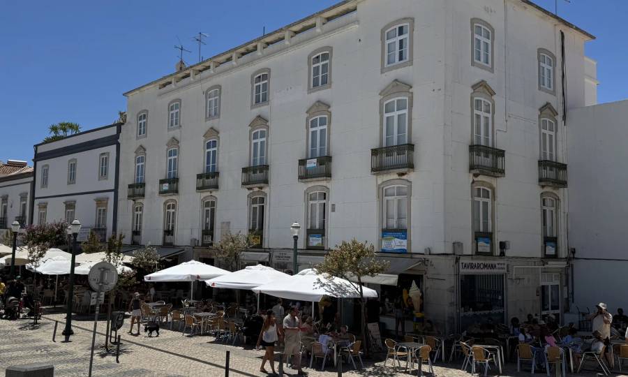
Stand in the middle of the Praça da República and look at the row of houses leaning up the hillside. It looks as it always has, or so it seems. But one of these houses has a case file in the municipal archive, and it tells a wilder story than the façade lets on.
At the end of the eighteenth century it stood here with three storeys and five bays, that is, five vertical rows of openings. Doorways at street level, small windows in the middle and, unusually, the fine floor at the very top, where the gentry lived behind their balcony doors. The house's backbone was already old by then. The row is built up against the city's medieval wall, and the stones of the wall still sit inside the walls of the houses.
Around 1900 the house got a new face with curved surrounds in imitation of the baroque, balconies on the middle floor and, at the top, an openwork balustrade with pinnacles. That era's way of saying "we keep up with the times". In 1954 modern life moved in. The building was divided into flats with maids' rooms with their own toilets, a sitting room with a small chapel was converted into a bedroom, and on the ground floor the two shops were remodelled into a pastry shop with a dairy counter and a fashion and tailoring shop. To make room for the big display windows, they cut through load-bearing walls, arches, vaults and a piece of the city wall itself. Later still, a fourth storey was added.
One building with traces of at least six centuries. At least five lives. That is the first clue, and it is the rule everything that follows builds on: the façade shows only the latest layer. This walk teaches you to see the layers beneath, and by the end you will be able to read any street in town yourself.
Chapitre 2
The Noble Language
You are now in old Tavira, inside the walls, and here the houses speak another language. The notaries of the eighteenth century drew a sharp distinction. A *morada de casas térreas* was a dwelling on one floor, a *morada de casas altas* one with an upper storey. And the tall houses had a grammar you can learn in five minutes.
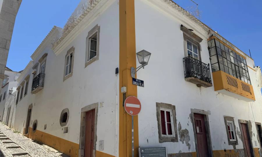
Look at the corner house where the Calçada da Galeria meets Rua Gonçalo Velho. At the bottom, a plain door. Above it, a balcony window in a stone surround. That is the module, door below and balcony above, and the balcony floor was the *piso nobre*, the fine floor. The stone around the window was a status signal. A plain surround was the standard. Add a small cornice, a projecting band above the lintel, and it was a notch finer, and a double lintel was the rare extra. So clue number two is simple: stone around the windows marks out the fine floor.
When the architect drew up the house's interior in 1954, he found four rooms on the ground floor separated by massive walls and connected by arches, and a vaulted ceiling the owner wanted replaced with a concrete slab "so that all the ceilings become level". That is how the old rooms could disappear, one project at a time. But the module in the façade still stands.
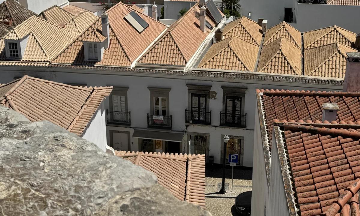
One more thing belonged to the noble language, namely the roof. In houses with a *telhado de tesouro*, each room usually got its own little pyramid roof, so a large house carried a whole mountain range of roofs. Tavira has more of them than any other town in the Algarve. Walk up the Calçada da Galeria to the square in front of the church, into the castle courtyard on the left, and look out over the city. The mountain range is still there.
Chapitre 3
Two Rooms and a Yard
From the church of Santiago, Rua das Olarias runs into the quarter once known as the Mouraria. After the Christian conquest of Tavira in 1242, the Muslim population was gradually pushed out to the area beyond the wall, where the Mouraria grew up. Later, house-based potters' workshops lined Rua das Olarias. Archaeologists have found kilns and ceramic production from the fifteenth and sixteenth centuries.
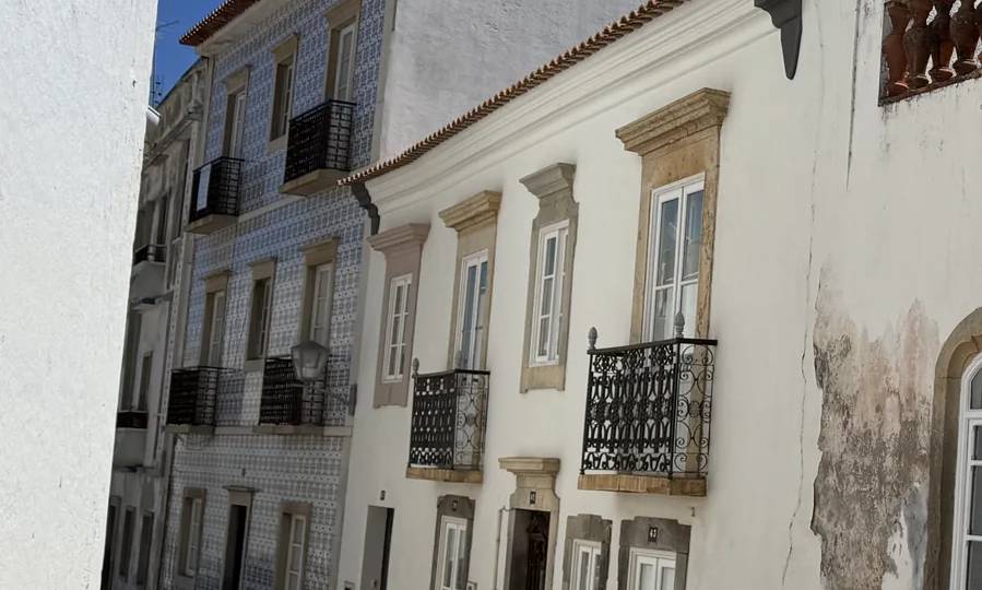
And the houses themselves? They show one of the most common ways of living in Tavira. The basic recipe recurs in one notarial document after another. At the front the *casa dianteira*, the room where you entered. Behind it the *câmara*, the chamber, where you slept. At the back, a small yard, sometimes with a well. A building contract from 1736, which we will come back to later on the walk, puts measurements to the model: two rooms and a yard on a plot with a frontage of barely five metres. The walls were rammed earth, *taipa*, more than half a metre thick and whitewashed with lime. If you needed more space, you built a kitchen in the yard, and from the second half of the nineteenth century the chamber in some houses was divided by a partition into two windowless alcoves.
Look at the rhythm of the street. Narrow frontage, a door and one window. Narrow frontage, a door and one window. Each beat can preserve the width of an old plot. When the owner of one of the street's houses applied to rebuild in 1944, the architect first drew up the old state of things, and there, behind the walls of the twentieth century, they still lay: two almost square rooms, front and back. Roof and windows had been replaced over the years, but the basic form from the notarial documents could still be recognised.
The third clue: count the beats. The narrow façades can preserve a layout that goes back to the late Middle Ages.
Chapitre 4
The Houses That Ate the Wall
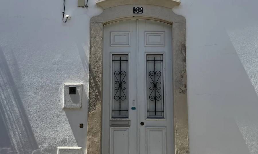
The corner house here, where Rua Dr. Miguel Bombarda meets Rua dos Mouros, stands close to the spot where the city gate Porta do Buraco once sat. The wall itself is hard to spot, and there is a reason for that. The houses have eaten it.
By the middle of the fifteenth century, the wall had already lost its military significance. The ban on building against it lapsed, and dilapidated towers were even given away as dwellings. When the engineer Alexandre Massai surveyed the fortifications in 1617, he noted drily that they would be difficult to repair, for there were "many houses stuck to the walls". The town had chosen sides. Home beat fortress.
Then three hundred years passed, and the pendulum swung back. In 1939 the walls were listed as a national monument, and suddenly the houses on the wall's back acquired paperwork. When the owner of the corner house wanted to replace his old wooden terrace with a concrete slab in 1963, the case had to be assessed against the monument. The municipality's reply survives. Paint *indoors* he could decide for himself. The façades came under the monument authorities. And the concrete slab was accepted because nearly all of the house still kept its pyramid roofs, and the slab replaced an existing veranda and yard area.
And now the best part. According to a survey from 1970, a possible Gothic portal is said to have appeared on the north side of the house during the rebuilding. The survey says, with due caution, that it "seems to await restoration". Look for the stone portal. It is clue number four. The city's wall is not gone. It stands inside the houses, waiting to be found.
Chapitre 5
The Quarter of Arches
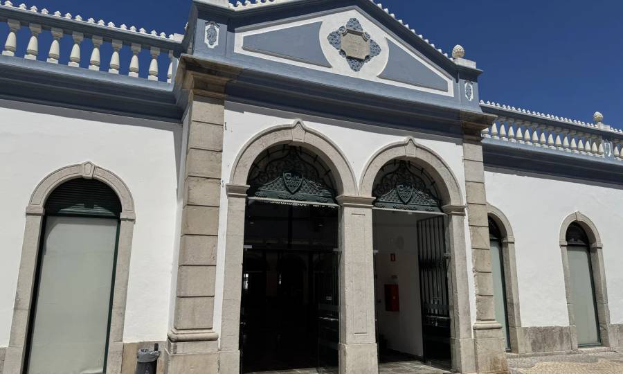
The quarter here by the river is called the Ribeira, and it was built by the city's golden age. In the fifteenth and sixteenth centuries Tavira was one of the most important towns in the Algarve, supply port for the Portuguese strongholds in North Africa, full of nobles, merchants and above all *mareantes*, the seafarers. They held royal privileges and, by the late fifteenth century, had their own brotherhood and their own hospital. The market building in front of you was inaugurated on 30 June 1887 after two years of construction, on a square then called Largo dos Mareantes, the seafarers' square.
Here is clue number five, and it is the easiest of them all. Look for arches in the ground floors. In the Ribeira you lived upstairs and worked downstairs. The ground floors were warehouses and shops with wide arched openings so the goods could move in and out. Upstairs lay the fine floor with the balcony windows, and at the back a roof terrace over the low outbuildings of the yard. As late as 1953, the architect Raul Lino described the street here, Rua José Pires Padinha, as the town's only real shopping street, with drapers, woollens and haberdashery door after door.
The notarial documents of the eighteenth century show that the seafarers kept investing in their houses in the quarter. The building files of the twentieth century show exactly what happened next. Old openings were altered, walls were moved to open up the rooms, and big display windows arrived. In one project from 1967, the architect defended replacing a pyramid roof with the words: it cannot be seen from the street anyway. So each century speaks its own language. But the arches can still be seen, if you look for them.
Chapitre 6
The Cord and the Contract
![The same quarter on two maps: at the top c. 1650, when the block around Rua da Silva did not yet exist; at the bottom c. 1797, when it had appeared. Details from Leonardo de Ferrari, Planta de la ciudad de Tavilla [c. 1650-1655], Krigsarkivet/Swedish Military Archives, SE/KrA/0414/0025/0011, and José de Sande Vasconcelos, Borrão do alçado da planta de Tavira [c. 1797], Acervo da Fundação Biblioteca Nacional – Brasil.](https://rrkivosxnrfvdawawexd.supabase.co/storage/v1/render/image/public/images/img-tavira/original/20260804_kortpar_kap6-rua-da-silva-1650-1797.webp?width=900&height=540&resize=cover&quality=70)
The streets here are strikingly straight. That is exactly how a piece of town planning from 1736 was meant to look, and we know precisely how it was to be carried out, because the contract lies in the district archive in Faro.
That year, a developer commissioned 50 small houses on the south-eastern edge of town, though the research suggests not all of them were built. The document prescribes the method. First a cord was to be stretched out, so the street would be *sem tortura alguma*, "without any crookedness". Then the plots were set out with four and a half *varas* of frontage, barely five metres, the front room square, the chamber slightly shorter and the yard at the back. Foundations of stone and clay. Walls of rammed earth, whitewashed with lime. Timber of good pine from Flanders, chestnut or poplar, and the roof was not to be "starved" of tiles. The street door was to be eight *palmos* high and five wide, 1.76 by 1.10 metres, with a hatch and a stone threshold. The chimney was to have "its cupboard with doors and its shelves". For the work, a master mason, a mason and a carpenter.
Fourteen years later, in 1750, eleven more houses of the same basic type were commissioned. And now comes the point. The block around Rua da Silva does not exist on the map from around 1650, but has grown up on the map from the late eighteenth century, and its plots still measure almost exactly what the contract prescribed. One of the houses, known from a 1967 building file, fits so well that the researchers behind this story judge that it may very well be one of the eleven.
If the researchers' hypothesis holds, you are standing in a street where the building contract for one of the houses still lies in the archive. With the chimney shelves, with the cord, with everything. That is clue number six, and it is the most important of the walk. The town's most anonymous streets can be its best documented.
Chapitre 7
The Other Bank
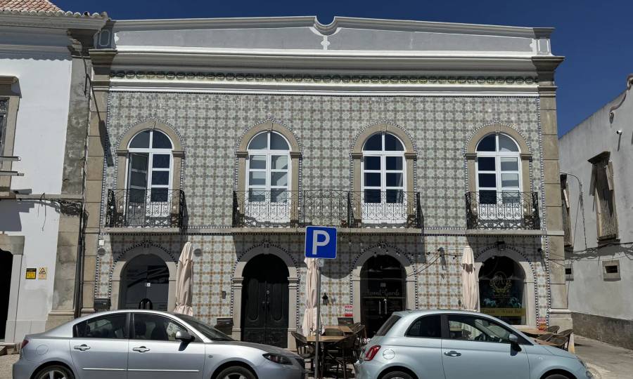
The geographer Orlando Ribeiro wrote that Tavira is the only Portuguese city born at a ford that has spread across both banks "without breaking its unity". The connection across the bridge is so close that the quarter on the opposite bank is simply called "the other side".
Cross over, then look at the row of houses along the riverbank to the right, in Rua Jacques Pessoa. A drawing from around 1796 shows precisely this row and puts names to it. Here lived the governor of the fortress, the royal administrator and the judge of orphans' inheritances. The address of power, then with balcony windows and pyramid roofs in the classical manner.
But what you see today looks different. Tile-clad façades, round-arched windows in a regular beat, and at the top a *platibanda*, the low parapet that hides the roof. That is the nineteenth-century facelift. When the economy turned after mid-century and the town laid out its riverside promenade with market and garden, the façades along the river were modernised. Eaves were removed, platibandas arrived, windows were arranged symmetrically, and the façades were clad in tiles.
Here is the seventh clue. An ornamented *platibanda* often points to a façade rebuilt in the late nineteenth or early twentieth century. But it dates only the façade, not the house behind it. When the ground floor of the governor's house was rebuilt in 1966, the massive old walls still stood on the drawings, and everything suggests the pyramid roofs also survived behind the tiled exterior. The facelift was just that, only a face.
Chapitre 8
What Should Not Be Lost
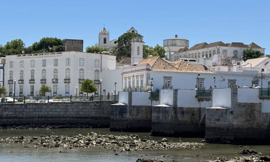
Look out over the city one last time. The white façades, the balcony windows, the pyramid roofs. Why does all of this still exist?
There are three answers. The first is an earthquake. The catastrophe of 1755 flattened Lisbon and ravaged the western Algarve. It struck Tavira too, but here in the east the consequences were less sweeping than in the centre and west of the region. Many older building structures survived, and the craft lived on. As late as the mid-twentieth century, any master builder in Tavira could lay a *telhado de tesouro*. The second answer is stagnation. From the second half of the sixteenth century the town declined, partly as the North African strongholds lost importance, merchants moved away, and the harbour silted up. The long stagnation limited the great rebuildings and thus, paradoxically, became a preservative. The third answer is a choice. When Tavira was to have a town plan after 1948, the architect chosen was Raul Lino. The neighbouring plans for Faro and Olhão prescribed clearance with a hard hand, but Lino wrote of Tavira that "the city has typical features which it would be desirable not to lose". The municipality followed his line, and in the 1980s came the formal conservation plan for the historic centre.
The earthquake, which the town, despite damage, weathered more gently than the western Algarve. The stagnation, which held back the great rebuildings. The plan, which chose to preserve. That is why you can stand here today and read traces of more than six hundred years in a single row of houses.
And now you can do it. The façade shows only the latest layer, but the layers can be read. The beat of the façades can preserve the old narrow plots. The arches point to warehouses and trade. The stone surround marks out the fine floor. The platibanda often points to a later façade rebuild. The wall hides inside the houses, and beneath it all lies the cord of 1736, still stretched out, still without any crookedness. Enjoy the walk. The rest of the city is yours to read.
Sources
- ROMBA, Sandra & COSTA, Miguel Reimão, «Transformação e permanência da arquitetura doméstica em Tavira do Antigo Regime ao século XX. Uma interpretação a partir das fontes documentais e cartográficas», FOLIUM – Revista do Arquivo Municipal de Tavira, Câmara Municipal de Tavira, 2026
- SIPA/DGPC: Núcleo urbano da cidade de Tavira (IPA.00010025), Muralhas do Castelo de Tavira (DGPC 70656)
- Município de Tavira, Estudos de Caracterização e Diagnóstico da Revisão do PDM de Tavira, Vol. III, 2016-2017
- Câmara Municipal de Tavira: «Outro património»; Mercado Municipal de Tavira, «A nossa História»; «Passeios na História de Tavira: Platibandas na margem oriental de Tavira»
- Museu Municipal de Tavira: «Tavira Islâmica – As olarias do Arrabalde da Bela Fria»; «Azulejos de fachada em Tavira»
- SANTANA, Daniel, «A história atravessa o rio: a ponte antiga de Tavira (e outras travessias)», in As Travessias do Rio Gilão em Tavira, 2021
- A Casa Senhorial, Glossário: «Câmara»
- Adapted by Flemming Berthelsen, based on research by Sandra Romba and Miguel Reimão Costa
Dernière révision : 4 septembre 2026