Quellen & alte Karten
Historische Karten & Bilder
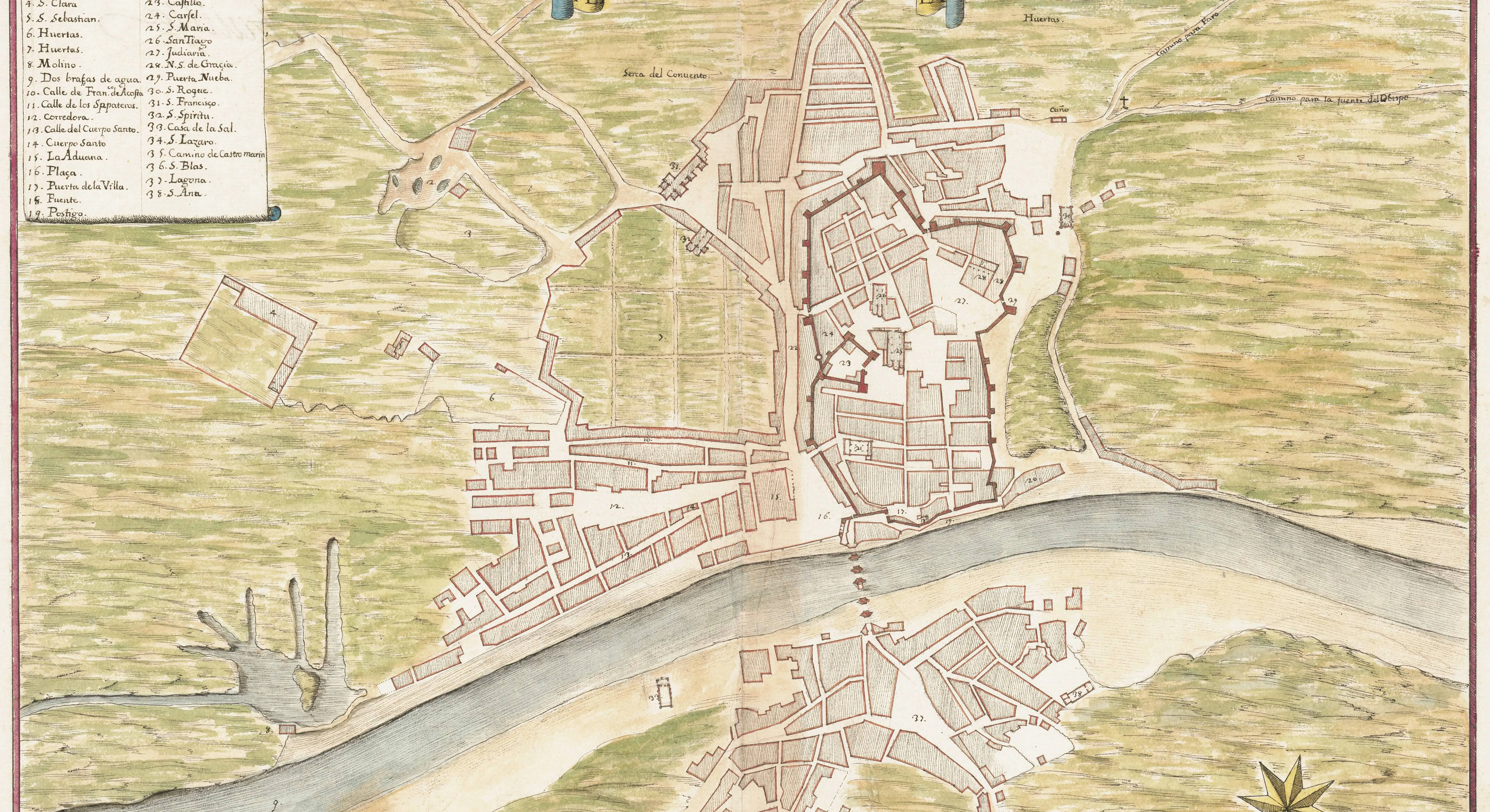
Stadtplan von Tavira aus dem 16. Jahrhundert (Originalkarte)
Leonardo de Ferraris Plan von Tavira aus dem Atlas de Heliche (um 1655, nach einer portugiesischen Vorlage des 16. Jahrhunderts), aufbewahrt im schwedischen Reichsarchiv – hochauflösend und gemeinfrei.
Planta de la ciudad de Tavilla, Leonardo de Ferrari [ca. 1650-1655]. Krigsarkivet/Riksarkivet, SE/KrA/0414/0025/0011.
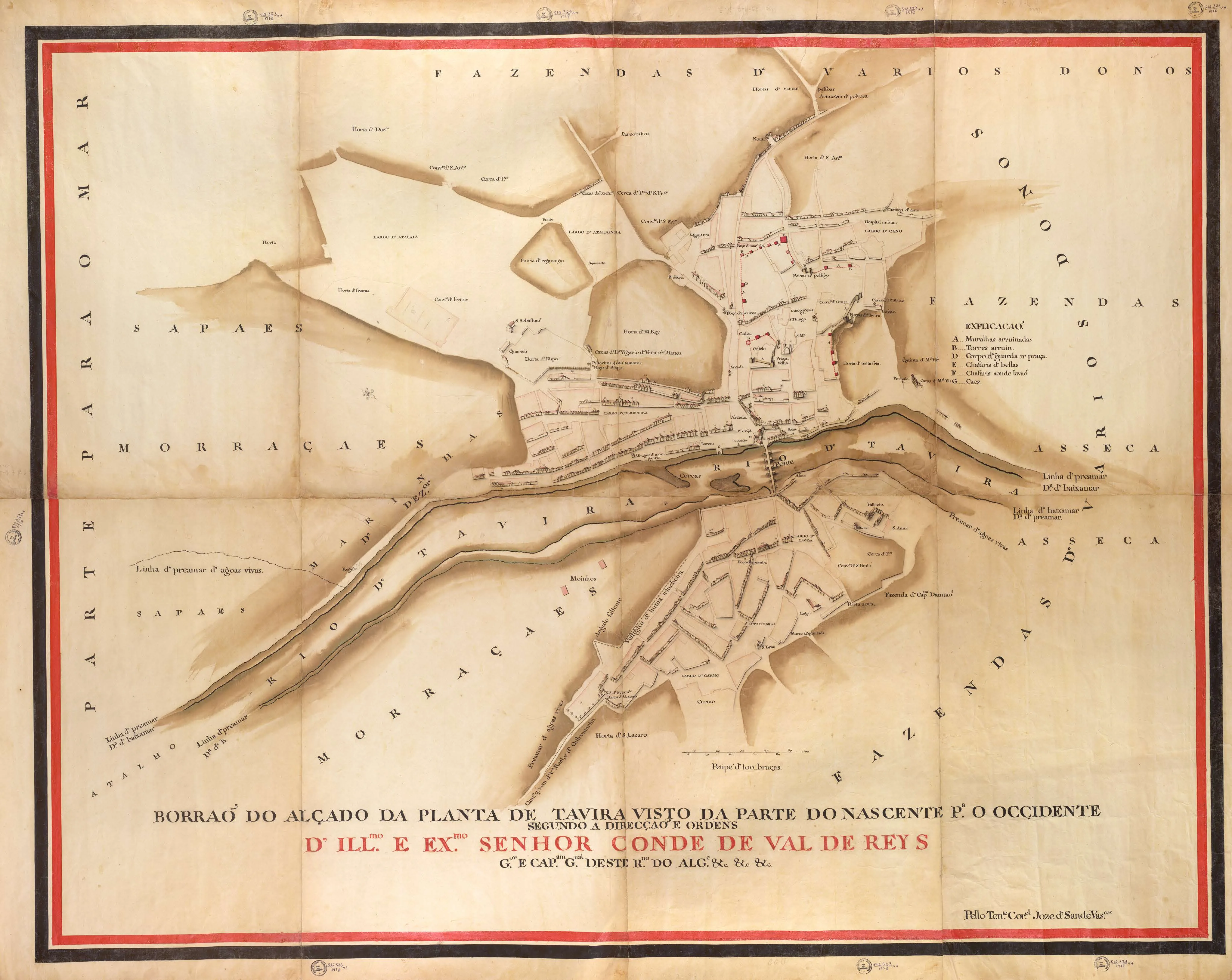
Tavira aus der Vogelperspektive, um 1797 (Originalkarte)
Die Stadt aus der Vogelperspektive von Osten, gezeichnet von José de Sande Vasconcelos um 1797 im Auftrag des Conde de Val de Reys. Das Original befindet sich in der Nationalbibliothek Brasiliens – in hoher Auflösung und gemeinfrei.
Borrão do alçado da planta de Tavira, José de Sande Vasconcelos, c. 1797. Acervo da Fundação Biblioteca Nacional – Brasil.
A newly discovered 16th century map of Tavira
Detailed article about a historical map of Tavira from the mid-16th century, discovered in the Military Archives of Stockholm.
A 17th century engraving of Tavira
Detailed analysis of a historical engraving of Tavira from the first half of the 17th century (1641-45). The study includes an interpretation of the architectural and urban elements depicted, focusing on the fortifications, churches, and public buildings of the period.
Karte von Tavira und Umgebung, ca. 1780–97
José de Sande Vasconcelos' handkolorierte Manuskriptkarte "Cidade de Tavira e seus arredores" – frei und hochauflösend verfügbar in der Portugiesischen Nationalbibliothek.
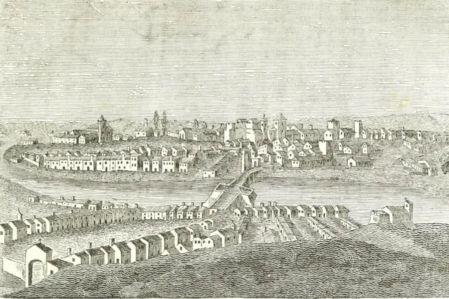
O Panorama magazine (1843)
Article from the journal O Panorama (8 July 1843) with an engraving and a detailed description of Tavira. The full volume is freely available on the Internet Archive.
O Panorama, 2.ª série, vol. II, 8 de julho de 1843, p. 209. Internet Archive.
City Map of Tavira from 1913
Detailed historical city map from 1913, surveyed by officers of the 4th Infantry Regiment and drawn by Henrique da Conceição Monteiro. Includes a cartographic study of urban forms and functions.
Offizielle Seiten & weiterführende Links
Tavira Municipal Museum
Official portal of the Tavira Municipal Museum with information about exhibitions, collections, online publications, opening hours, tickets and cultural activities. Includes programs for schools and families, as well as special events and current news.
Descobrir Tavira – das offizielle Kulturerbe-Portal
Offizielles Portal der Stadtverwaltung von Tavira zum Kulturerbe der Stadt: Museen, religiöses Erbe, Denkmäler und kulturhistorische Routen.
Kirchen, Kapellen und Klöster von Tavira
Offizieller Katalog der Stadtverwaltung mit rund 25 Kirchen, Kapellen und Klöstern in Tavira, mit Geschichte und Architektur – von Santa Maria do Castelo bis São Francisco.
Algarve History Association
Englischsprachiger Verein, der die Geschichte Portugals und der Algarve mit kostenlosen Vorträgen (regelmäßig in Tavira), Artikeln und Newslettern vermittelt. Mehrere Artikel handeln von Tavira: die Geschichte der Stadt, die Wasserversorgung, das maurische Erbe und das Kriegerdenkmal. Einige davon sind Quellen dieses Guides.
Tavira auf Wikipedia
Gut belegter Enzyklopädie-Artikel zur Geschichte Taviras – von phönizischer und römischer Zeit über die maurische Herrschaft bis heute. In über 40 Sprachen verfügbar.