Sources & Old Maps
Historical maps & images
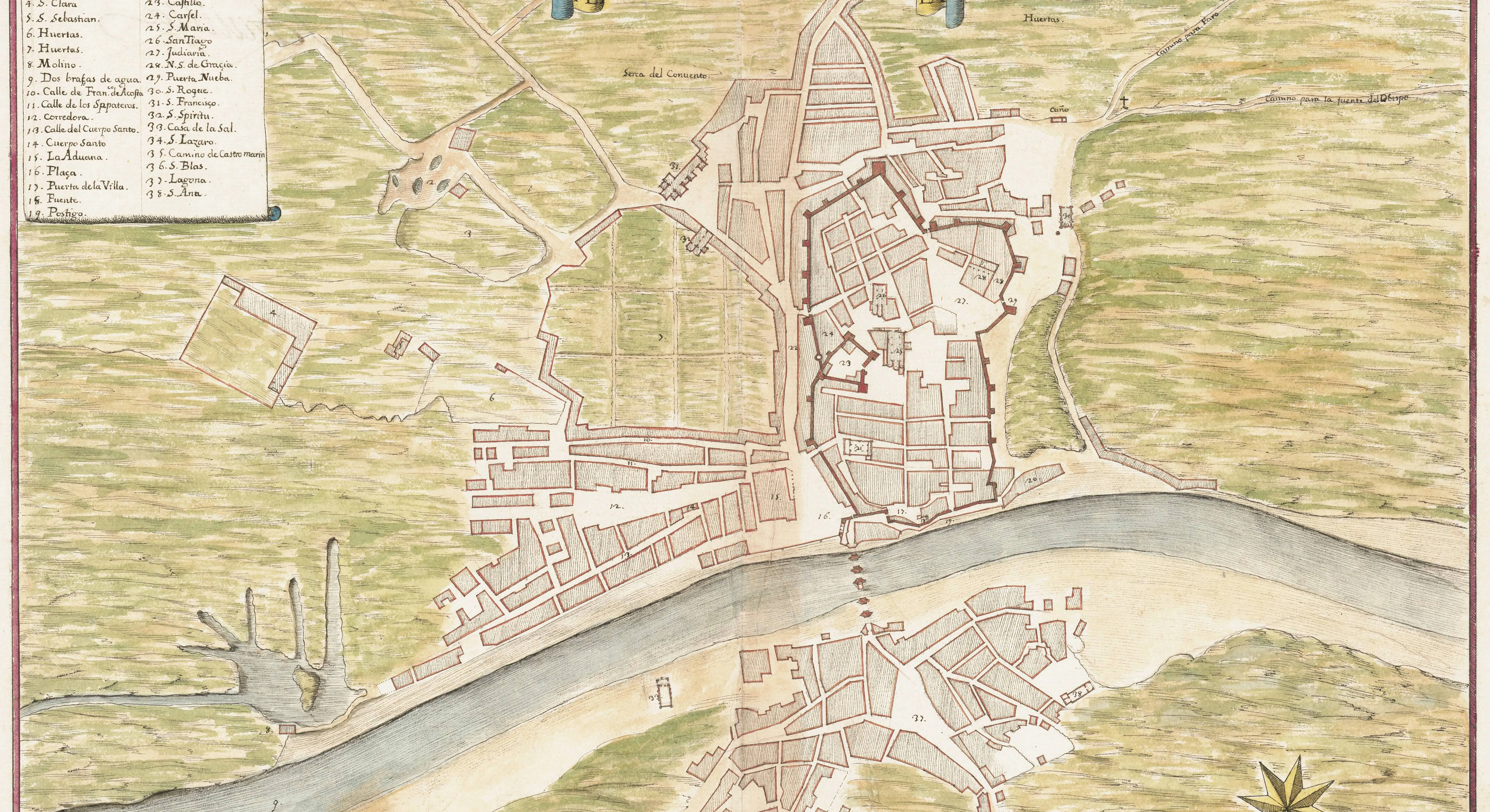
16th-century plan of Tavira (the original map)
Leonardo de Ferrari's plan of Tavira from the Atlas de Heliche (c. 1655, after a 16th-century Portuguese original), held at the National Archives of Sweden – high resolution, public domain.
Planta de la ciudad de Tavilla, Leonardo de Ferrari [ca. 1650-1655]. Krigsarkivet/Riksarkivet, SE/KrA/0414/0025/0011.
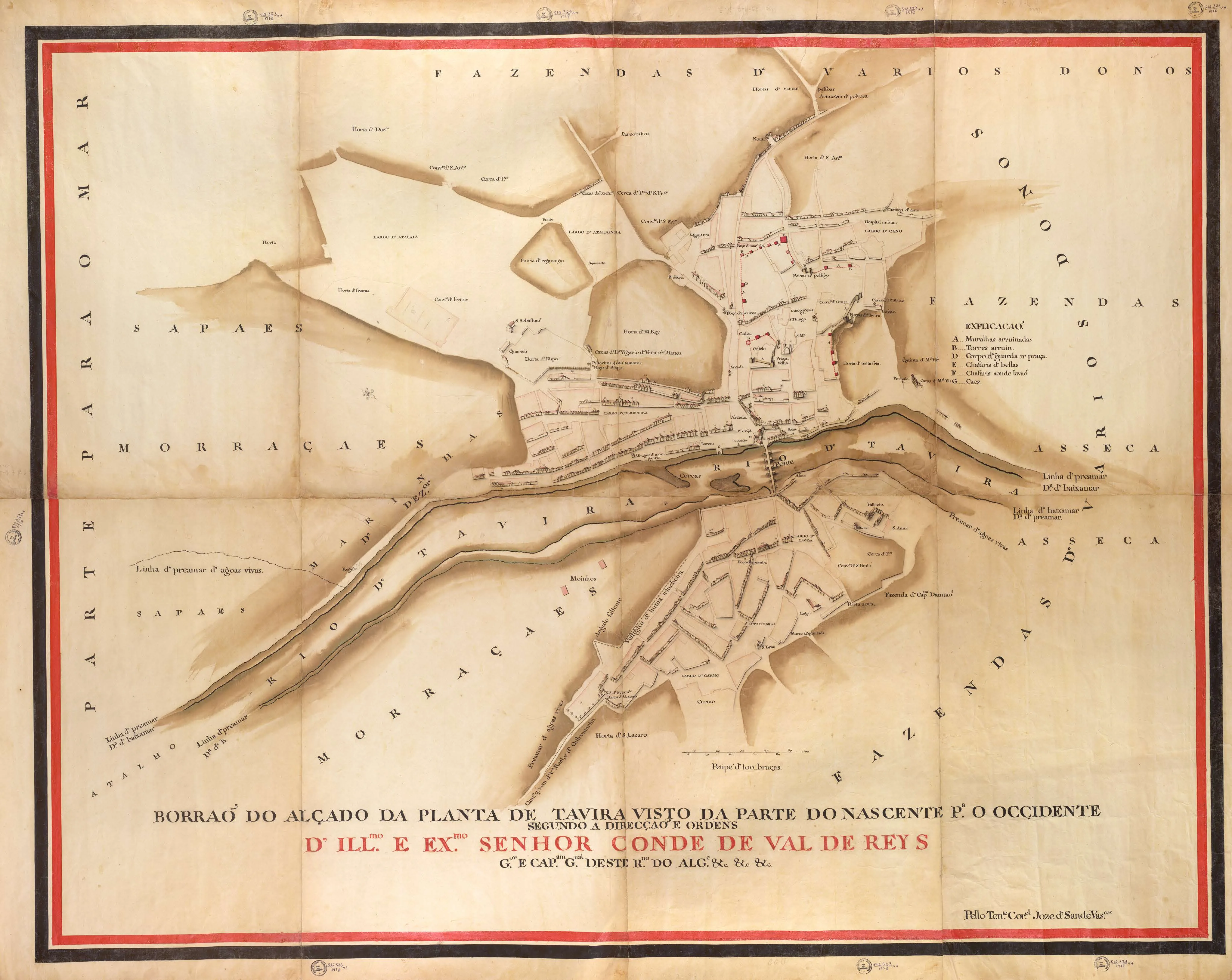
Bird's-eye view of Tavira, c. 1797 (the original map)
A bird's-eye view of the town seen from the east, drawn by José de Sande Vasconcelos c. 1797 by order of the Conde de Val de Reys. The original is held by the National Library of Brazil – high resolution, public domain.
Borrão do alçado da planta de Tavira, José de Sande Vasconcelos, c. 1797. Acervo da Fundação Biblioteca Nacional – Brasil.
A newly discovered 16th century map of Tavira
Detailed article about a historical map of Tavira from the mid-16th century, discovered in the Military Archives of Stockholm.
A 17th century engraving of Tavira
Detailed analysis of a historical engraving of Tavira from the first half of the 17th century (1641-45). The study includes an interpretation of the architectural and urban elements depicted, focusing on the fortifications, churches, and public buildings of the period.
Map of Tavira and its surroundings, c. 1780–97
José de Sande Vasconcelos' hand-coloured manuscript map "Cidade de Tavira e seus arredores" – freely available in high resolution from the National Library of Portugal.
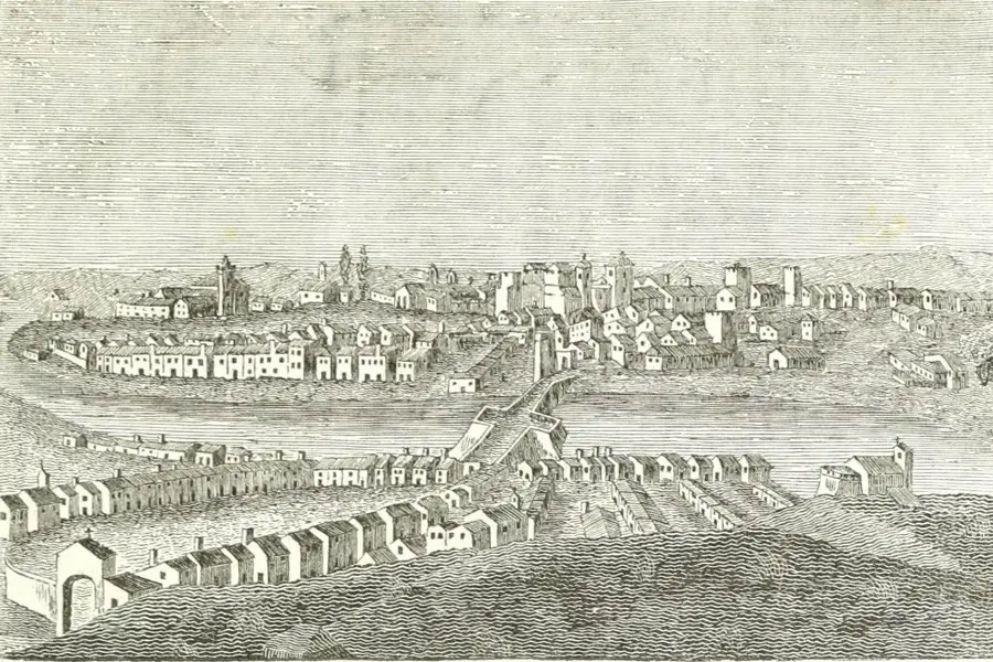
O Panorama magazine (1843)
Article from the journal O Panorama (8 July 1843) with an engraving and a detailed description of Tavira. The full volume is freely available on the Internet Archive.
O Panorama, 2.ª série, vol. II, 8 de julho de 1843, p. 209. Internet Archive.
City Map of Tavira from 1913
Detailed historical city map from 1913, surveyed by officers of the 4th Infantry Regiment and drawn by Henrique da Conceição Monteiro. Includes a cartographic study of urban forms and functions.
Official sites & further reading
Tavira Municipal Museum
Official portal of the Tavira Municipal Museum with information about exhibitions, collections, online publications, opening hours, tickets and cultural activities. Includes programs for schools and families, as well as special events and current news.
Descobrir Tavira – the town's official heritage portal
Official portal of the Municipality of Tavira presenting the town's cultural heritage: museums, religious heritage, monuments and cultural routes.
Churches, chapels and convents of Tavira
The municipality's official catalogue of some 25 churches, chapels and convents in Tavira, with history and architecture – from Santa Maria do Castelo to São Francisco.
Algarve History Association
English-language association that presents the history of Portugal and the Algarve through free talks (regularly in Tavira), articles and newsletters. Several of the articles are about Tavira: the town's history, its water supply, its Moorish legacy and the war memorial. Some of them are sources for this guide.
Tavira on Wikipedia
Well-referenced encyclopedia article on Tavira's history – from Phoenician and Roman times through Moorish rule to the present day. Available in more than 40 languages.